


Environmental Planning
Andalusia Island Complex Project Implementation Report with Integrated Environmental Assessment
GreenPoint prepared the Project Implementation Report and Integrated Environmental Assessment (PIR/EA) for the Andalusia Island Complex as part of the Navigation and Ecosystem Sustainability Program (NESP), a long-term federal initiative to restore and enhance aquatic and floodplain ecosystems throughout the Upper Mississippi River System. The project area encompasses approximately 557 acres of degraded aquatic, wetland, and floodplain habitat on federally owned lands managed for conservation purposes. Historic alterations from lock and dam construction, channelization, sedimentation, and prolonged inundation have fragmented habitat, reduced forest regeneration, and converted wetlands into low-quality habitat monocultures. GreenPoint led an interdisciplinary team to perform the plan formulation and alternatives analysis for the PIR/EA, which included development of ecosystem restoration planning objectives, development of management measures, screening and evaluation of alternatives using hydraulic modeling, and selection of a Recommended Plan. Key objectives included increasing deep-water overwintering fish habitat, decreasing sedimentation to support aquatic sustainability, and increasing topographic diversity to improve floodplain forest structure and resilience. Measures included backwater dredging, sediment control structures, and upland habitat creation through strategic placement of dredged material.
Development of Measures and Alternatives
To begin the planning process, GreenPoint developed preliminary management measures, drawing on a range of sources including engineering guidance, lessons learned from past ecosystem restoration projects, and standard design criteria. These measures addressed structural needs such as backwater dredging, topographic modification, and sediment control.
GreenPoint applied the planning objectives as a lens for refining the management measures and assembling alternatives. The team first focused on the primary objective—overwintering fish habitat—and developed 32 alternative plans using six habitat-focused measures. These were strategically paired with topographic diversity measures in nearby locations to reduce sediment transport distances and minimize material handling costs. Additional features such as access channels, sediment and flow reduction structures, and bank stabilization were added based on the components of each alternative.
Screening of Alternatives
GreenPoint was able to screen the 32 initial alternatives using the four formulation and evaluation criteria: effectiveness (acres of habitat created), efficiency (habitat benefit per cubic yard of dredged material), acceptability (regulatory compliance and partner agency input), and completeness (ability to meet planning objectives and legal requirements). Using AutoCAD Civil 3D, GreenPoint developed dredged material quantities for each alternative and evaluated these against the first two screening criteria. This approach enabled the PDT to refine the initial alternatives to a focused final array, prioritizing alternatives with the highest ecological value and operational feasibility.
Hydraulic Modeling of Alternatives
To support final array refinement, GreenPoint developed a 2D HEC-RAS hydraulic model to simulate flow velocities and water surface elevations for each alternative. Model outputs were used to assess the suitability of proposed measures—particularly overwintering fish habitat—and to determine the necessity and placement of supporting structures such as sediment control measures and bank stabilization. This modeling effort ensured that alternatives met both ecological objectives and hydraulic performance criteria.
Environmental Assessment
Alongside the planning effort, GreenPoint completed an Environmental Assessment (EA) in compliance with the National Environmental Policy Act (NEPA). The assessment identified environmental resources within the project area and evaluated both beneficial and adverse effects of each final array alternative. This process ensured that environmental consequences were fully considered, documented, and integrated into project decision-making in accordance with federal environmental compliance requirements.
Evaluation and Comparison of Final Array of Alternatives
To effectively compare the final array of alternatives, GreenPoint evaluated both the costs and ecosystem benefits of each plan. Class 4 cost estimates were developed using quantities generated in AutoCAD Civil 3D, with contingencies applied based on a comprehensive risk assessment. Habitat benefits were quantified using the U.S. Fish and Wildlife Service’s Habitat Evaluation Procedures (HEP), which calculate habitat quality and quantity through Habitat Suitability Indices (HSIs). HSIs were multiplied by the applicable habitat area to derive Habitat Units (HUs) for key aquatic and floodplain species.
To support long-term planning, both costs and HUs were annualized over a 50-year period using the IWR Planning Suite II tool, producing annualized cost estimates and net Average Annual Habitat Units (AAHUs). These metrics formed the basis of a detailed Cost Effectiveness and Incremental Cost Analysis (CE/ICA), which allowed the PDT to compare alternatives in terms of cost per unit of ecological output. The CE/ICA results directly informed the selection of the Recommended Plan by identifying the most cost-effective and environmentally beneficial solution.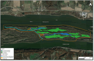
Alamo Dam and Painted Rock Dam Master Plan Update
The U.S. Amy Corps of Engineers, Los Angeles District regularly conducts operation and maintenance activities at all itsdams and surrounding operational areas. As part of this mission, USACE requires up-to-date Master Plans to guide the long-term, comprehensive management of recreation, natural, and cultural resources. A Master Plan is a strategic land use document that supports efficient, cost-effective, and sustainable management of Corps-owned lands throughout the life of a project.
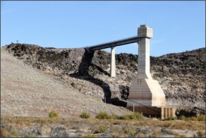
GreenPoint led a multi-disciplinary team of environmental planners, biologists, and engineers to update the outdated Master Plans for Alamo Dam and Painted Rock Dam. These dams, located near Wenden, AZ and Gila Bend, AZ respectively, encompass a combined total of more than 68,000 acres of federally owned land. The updated Master Plans provide a 25-year strategic vision for land classification, resource stewardship, and stakeholder engagement.
The Master Plans were developed in full compliance with applicable USACE regulations, including Engineer Regulation (ER) 1130-2-550 and Engineer Pamphlet (EP) 1130-2-550. The scope included a comprehensive inventory and analysis of existing environmental conditions, land uses, demographics, and community needs. Key aspects included updated land use classifications, management goals and objectives, and recommendations aligned with current Corps policies, statutory requirements, and stakeholder and public input.
Although the dams serve multiple authorized purposes—including recreation, water conservation, and habitat support—their primary function remains flood risk management. The Master Plans reflect this core objective while addressing current resource and land use considerations. The previous Master Plans, dated 1975 (Alamo) and 1961 (Painted Rock), were significantly outdated; the updated plans now serve as current and actionable guidance for USACE land and resource management for the next 25 years.
As required under the National Environmental Policy Act (NEPA), GreenPoint facilitated public scoping to engage stakeholders and solicit input during the Master Plan update process. In-person public meetings were held at Alamo Dam and at the Maricopa County Library in Maricopa, Arizona—near Painted Rock Dam—to present the planning process and gather feedback from local communities. During these meetings, GreenPoint presented an overview of the Master Plan update, outlined opportunities for public involvement, and provided instructions for submitting comments. Key topics addressed during scoping included proposed land classifications, management objectives for natural, cultural, and recreational resources, and anticipated recreation facility needs. Input received helped inform the development of the updated Master Plans and ensured alignment with community interests and resource stewardship goals.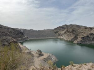
To meet requirements under NEPA, Environmental Assessments (EAs) were prepared for each dam in accordance with NEPA, Council on Environmental Quality (CEQ) regulations (40 CFR Parts 1500–1508), and Corps procedures (33 CFR Part 230). The EAs evaluated existing conditions and assessed the potential environmental impacts of both the No Action Alternative and the Proposed Action. They focused on natural, cultural, and human environments and incorporated the Master Plans’ resource management objectives, and helped inform the Master Plans.
Monitoring Plans for West Bank & Vicinity and Lake Pontchartrain & Vicinity Mitigation Projects
The US Army Corps of Engineers, New Orleans District tasked GreenPoint to develop project-specific monitoring plans for ten mitigation projects. Eight of these mitigation projects were developed as part of the Greater New Orleans Hurricane & Storm Damage Risk Reduction System (HSDRRS). The mitigation projects involve bottomland hardwoods, marsh (fresh, intermediate, or brackish marshes), and swamp habitats.
Besides addressing monitoring activities, these monitoring plans further address the applicable mitigation success criteria as well as anticipated schedules for the main mitigation and monitoring activities. As part of developing project-specific monitoring plans, GreenPoint participated in meetings with MVN and the Non-Federal sponsors, the National Fish and Wildlife Service and the Coastal Protection and Restoration Authority of Louisiana (CPRA). Work on the Bayou Sauvage Bottom Land Hardwood Mitigation project and the Bayou Segnette Bottom Land Hardwood & Swamp Mitigation project also entailed responding to various monitoring plan, report, and mitigation success criteria comments previously submitted by CPRA.
Project Specific Monitoring Plan Development
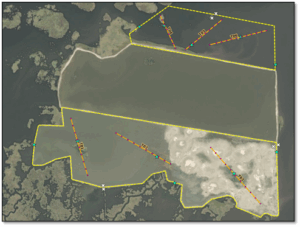 GreenPoint worked closely with MVN to develop the project-specific monitoring plans for each mitigation site. These plans include the associated mitigation success criteria and follow the general mitigation guidelines where possible but are ultimately informed by project-specific information from NEPA documents along with other considerations. The plans provide an overview of the key mitigation and design elements of the project.
Responses to Prior CPRA Review Comments
CPRA (the Non-Federal Sponsor) previously reviewed the latest monitoring reports as well as draft O&M manuals for the Bayou Sauvage Bottom Land Hardwood Mitigation project and the Bayou Segnette Bottom Land Hardwood Mitigation Project. Using those comments specific to the project monitoring plans and success criteria, GreenPoint prepared a draft document for each of the two cited mitigation projects. Each document presents each CPRA review comment followed by a draft response to each comment.